.jpg)
Gazetteer and Maps
All text and images on this web site are the intellectual property under copyright by the Center for Study of the Life and Work of William Carey, D.D. (1761-1834). Copying, reproducing, or reusing this material on web sites, electronic presentation, or publication is prohibited. For those who wish to use materials herein, please contact one of the co-directors.
Listed below are maps related to the life and work of William Carey.
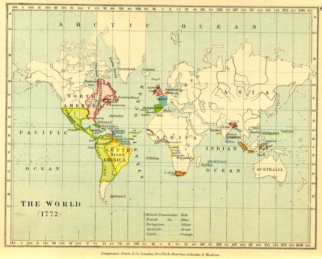
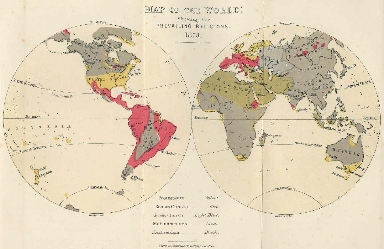
The World in 1873 Showing Baptist Missionary Society's Labor
(for a smaller version of this map, click here)
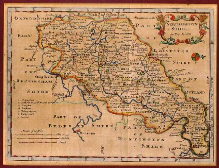
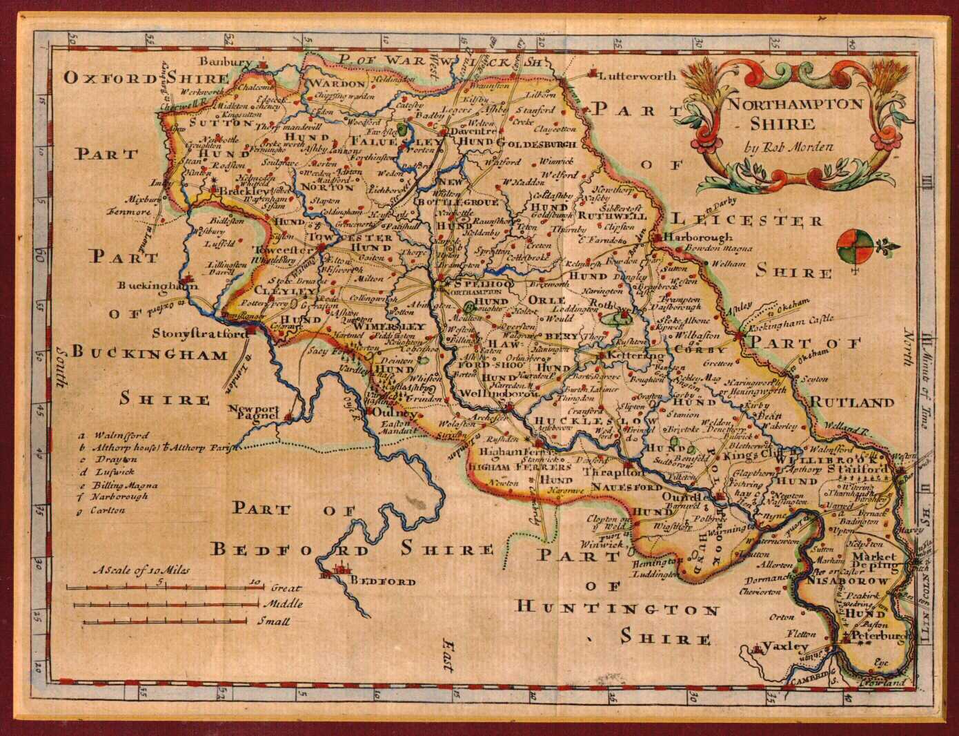
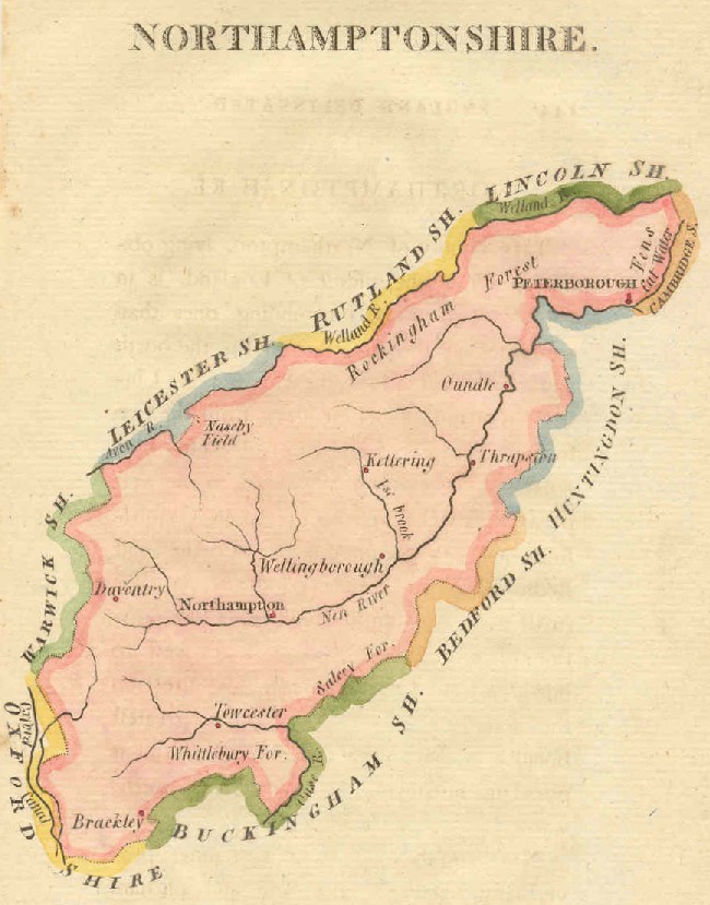
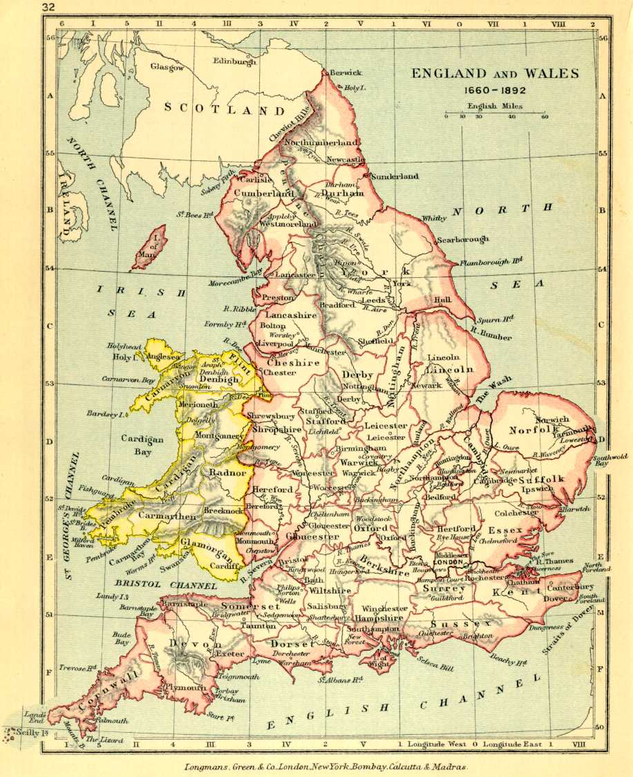
Northamptonshire, England (Detail)
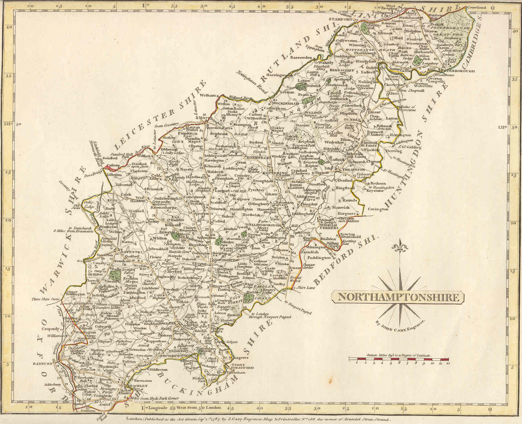
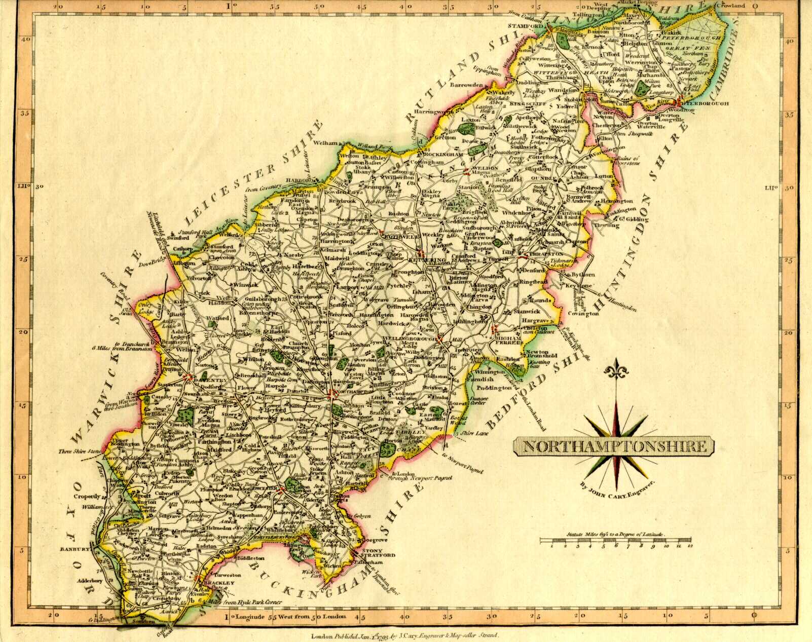
Northamptonshire, England, 1787
(J. Cary map)
(J. Cary map)
(J. Cary map)
(J. Cary map)
Northamptionshire, England, 1793, when William Carey Left for India
Northamptonshire, England, 1803
(John Aikin map, England Delineated, 1803)
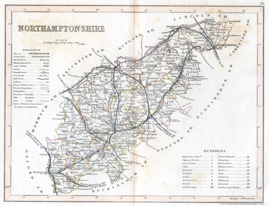
Northamptonshire, England, ca. 1840
(J. Archer, Pentonville, London)
(with railway routes)
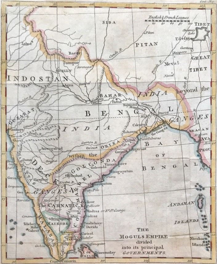
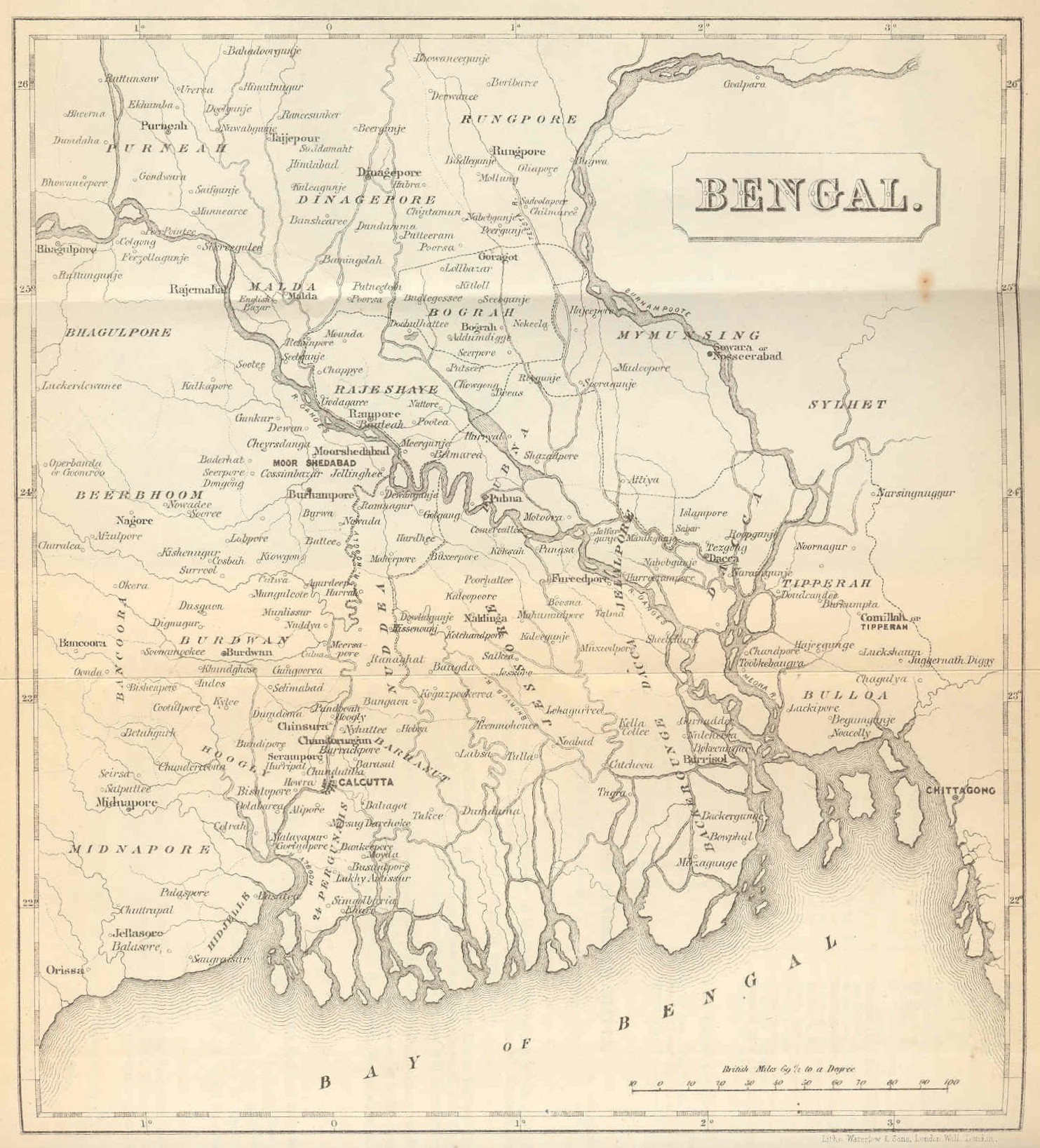
The Moguls Empire divided into its principal Governments, 1767 - Indostan Bengal
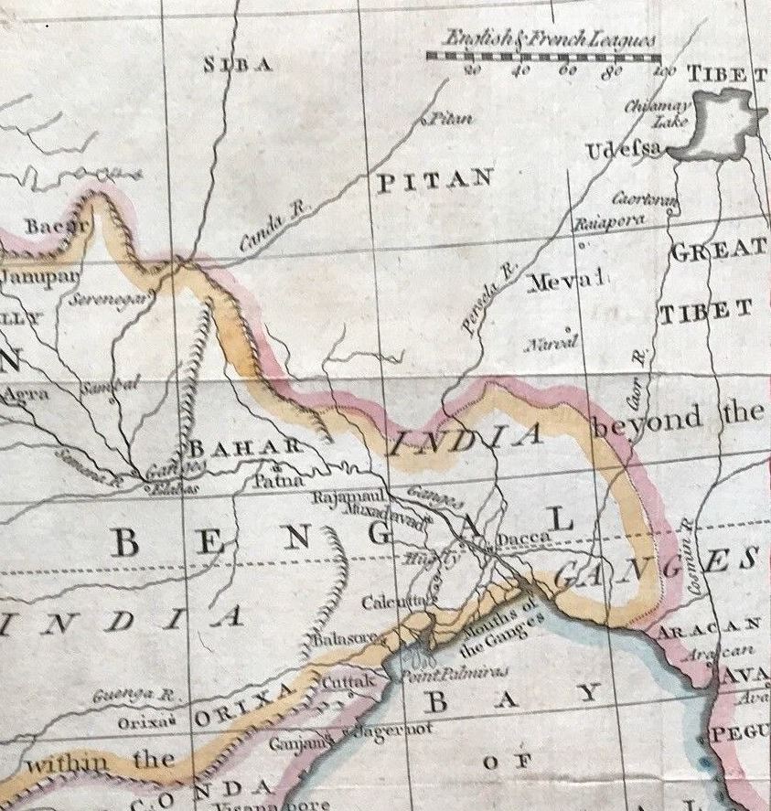
and Enlargement of the Bengal Portion
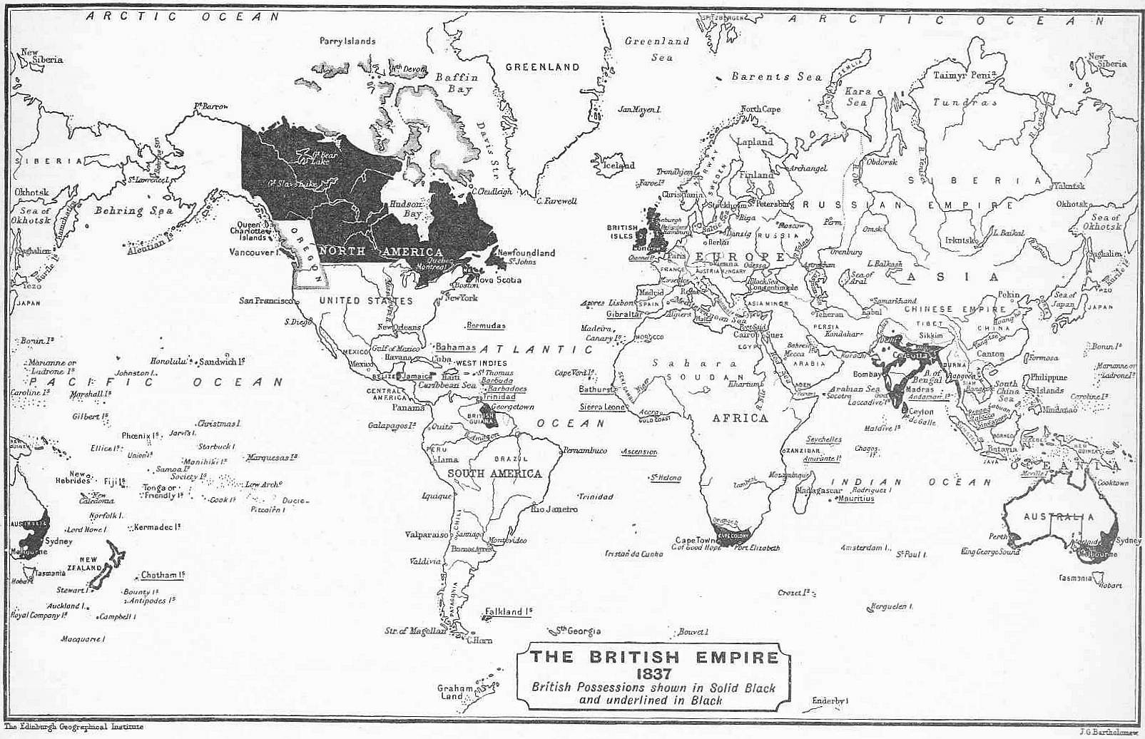
The Extent of the British Empire, 1837
Upon the Accession of Queen Victoria
The Extent of the British Empire, 1897
Celebrating the Diamond Jubilee of Queen Victoria
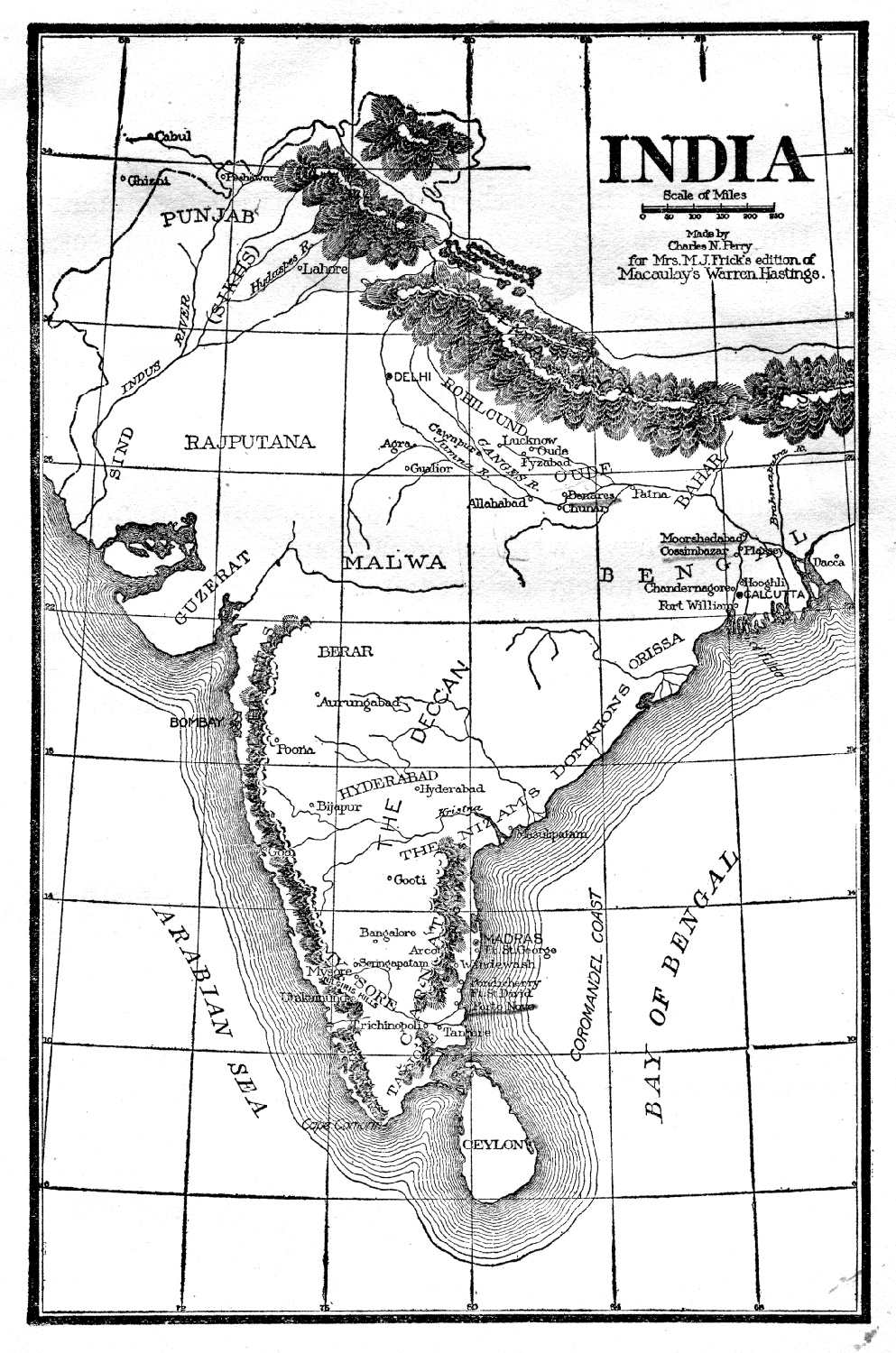
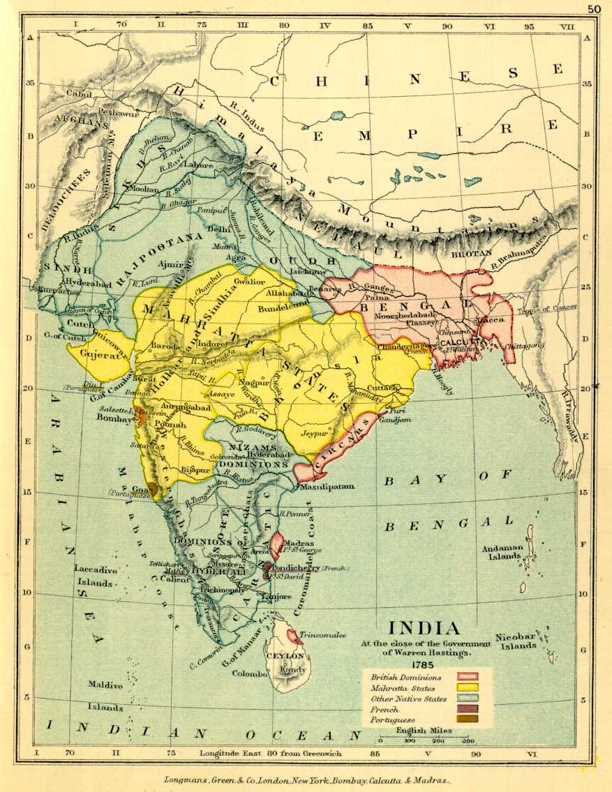
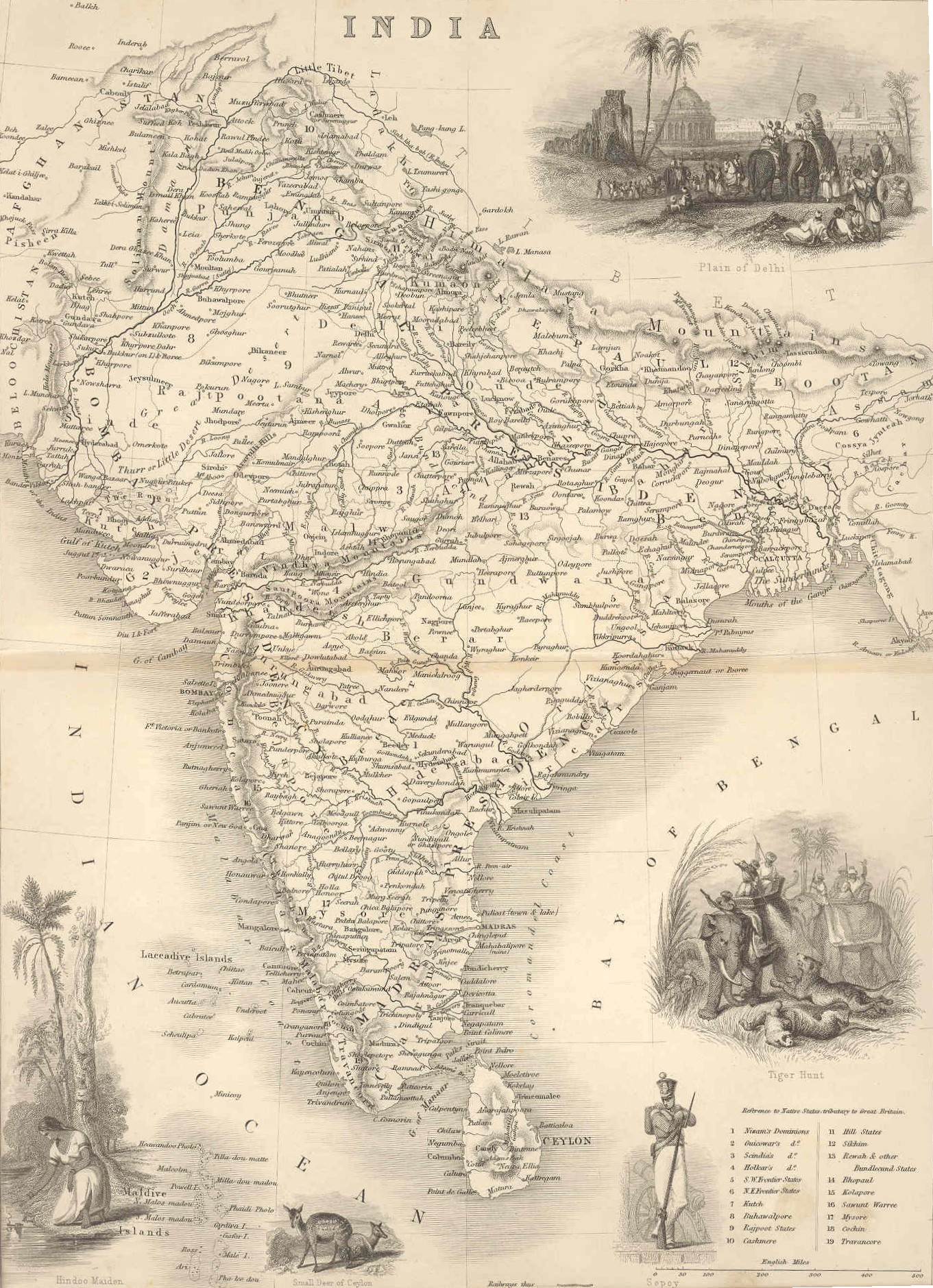
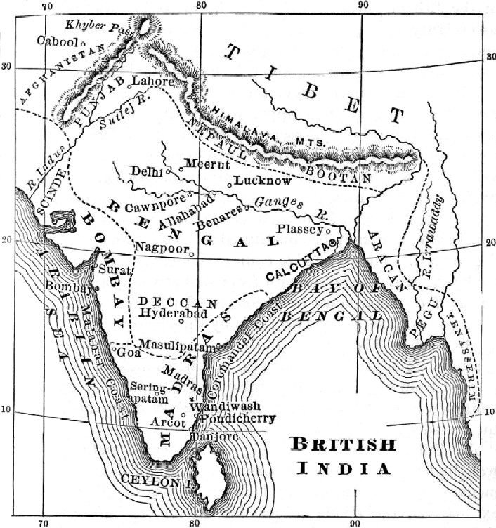
India under Governor General Warren Hastings, 1774-1786
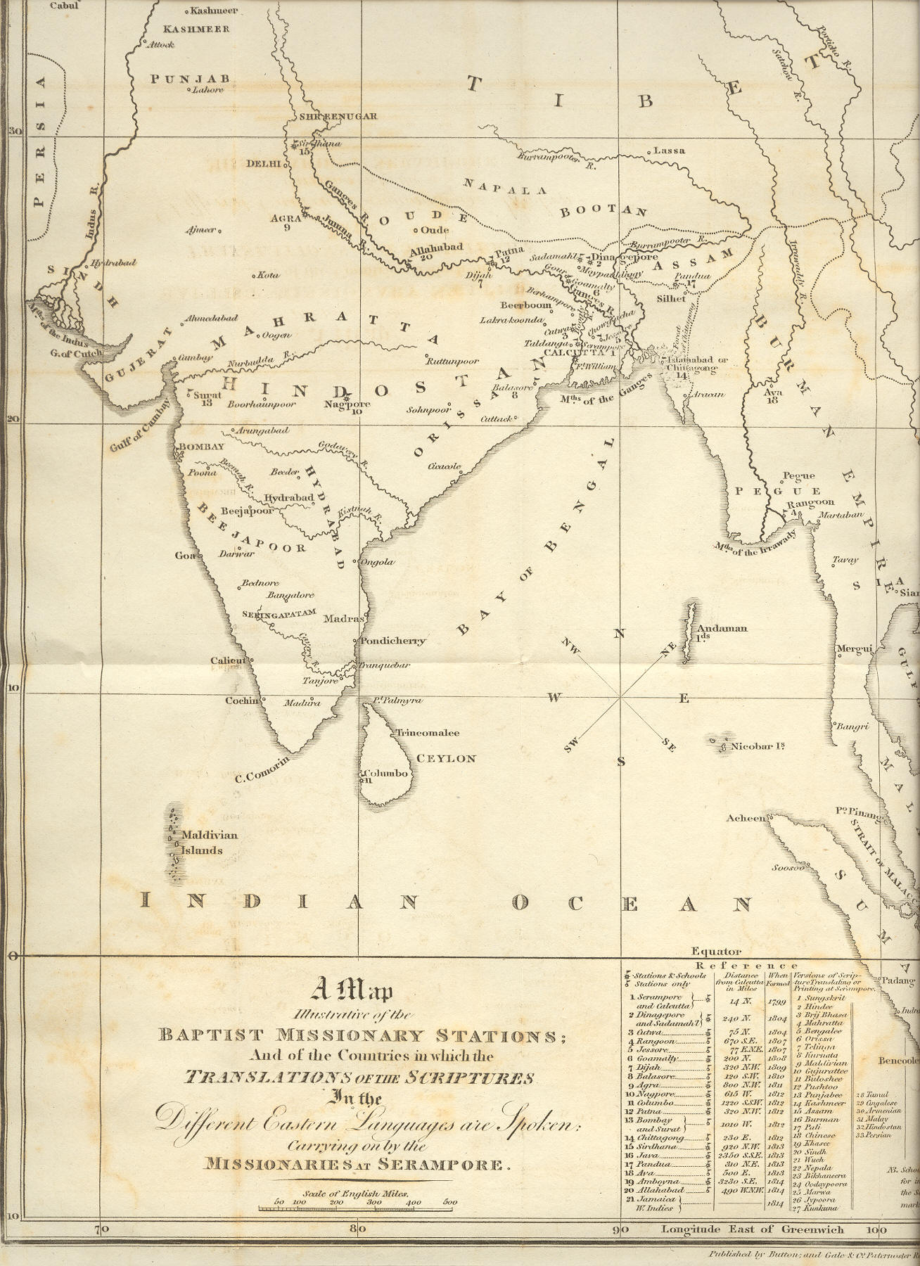
A Map Illustrative of the Baptist Missionary Stations; And of the Countries in which the Translations of the Scriptures In the Different Eastern Languages are Spoken: Carrying on by the Missionaries at Serampore (1819)
Exhibiting the extent to which it Various Languages are Spoken according to the best information for the seventh Memoir of Translations conducted by the Serampore Missionaries
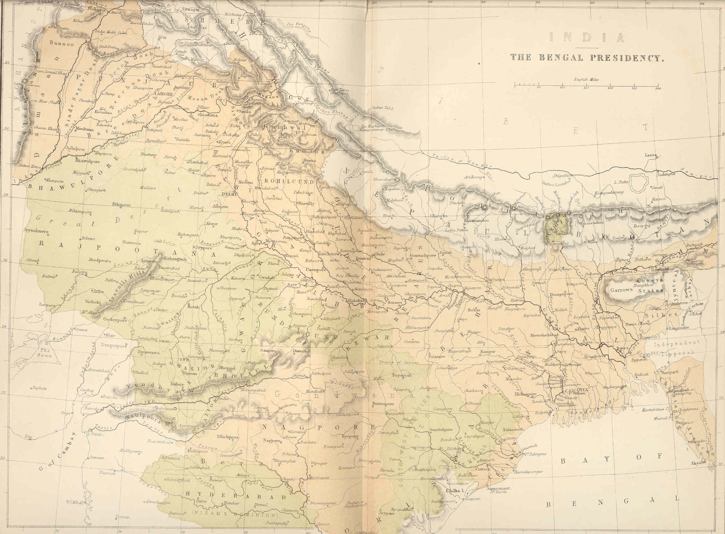
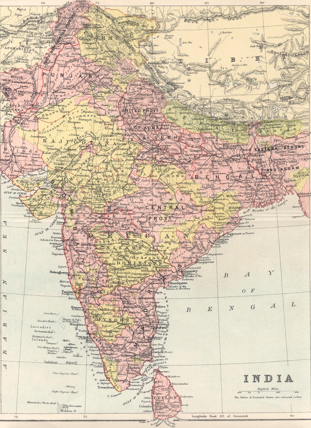
India, Bengal Presidency, 1831
India, Bengal, 1853 (very large color file)
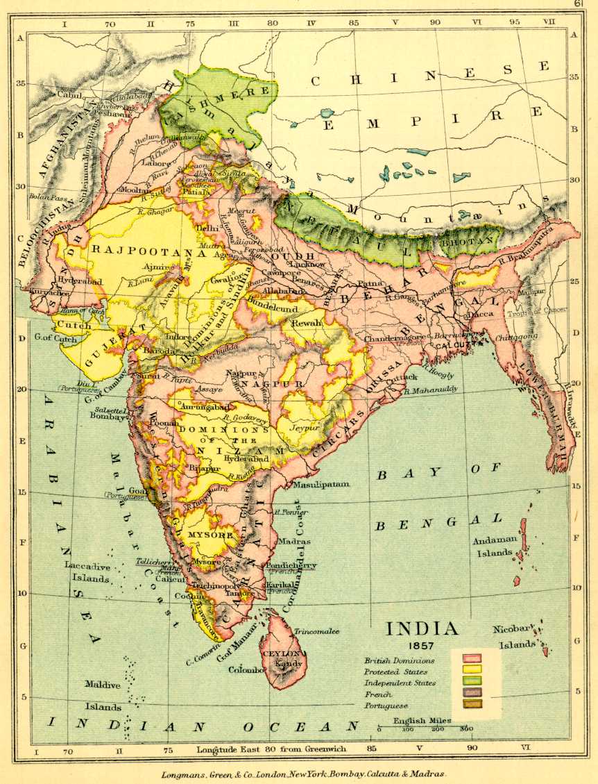
India, 1858 (very large file)
The Bengal Presidency, 1858 (very large file)
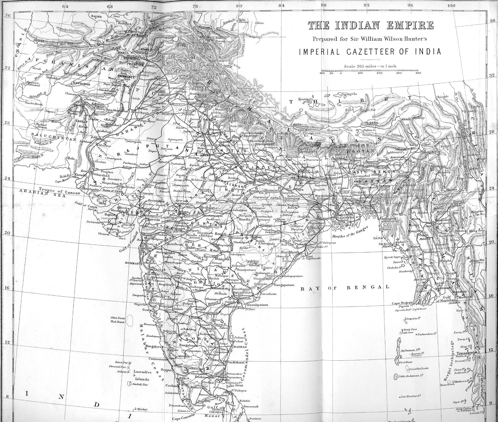
(Sir William Wilson Hunter)
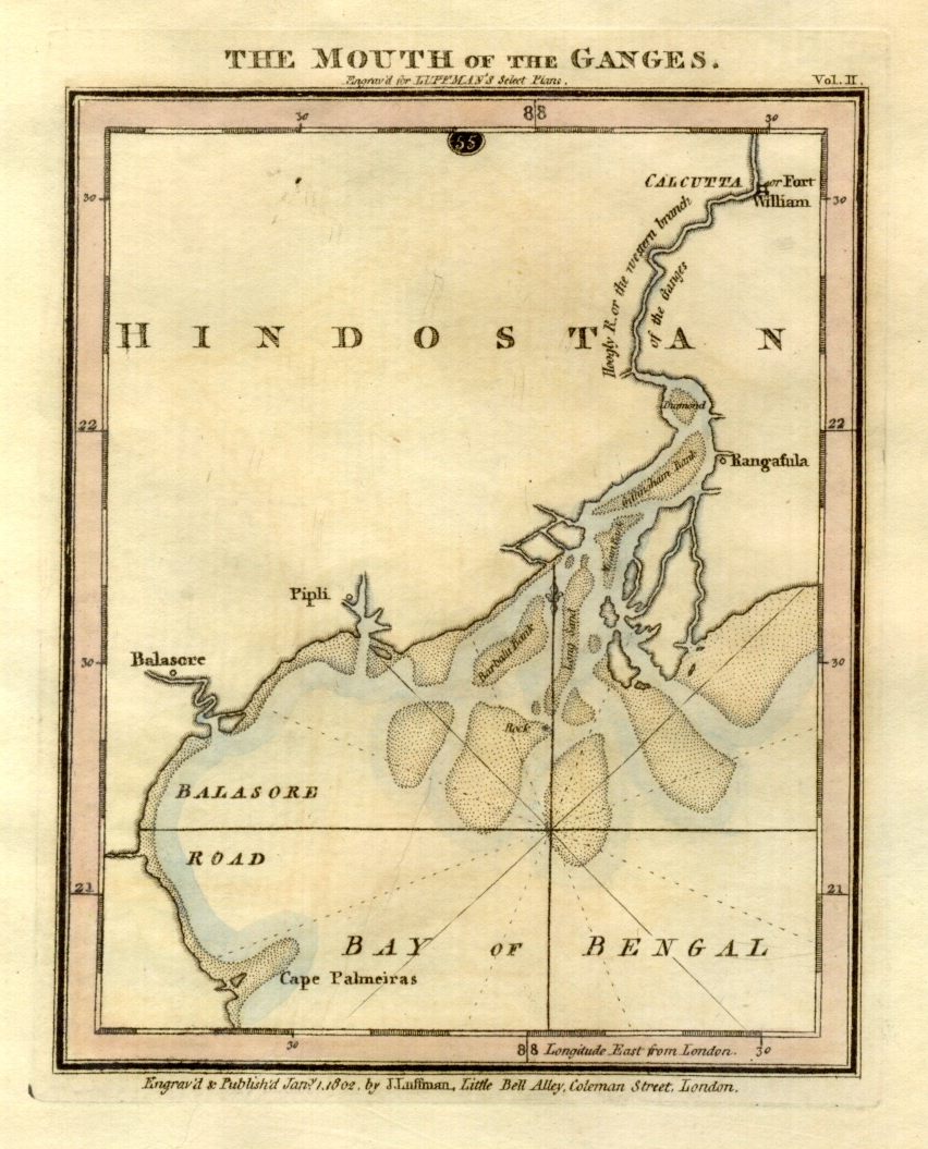
Published in January 1, 1802 by J. Luffman, London, this map illustrates the Ganges, the Hoogly River, Calcutta, and Fort William.
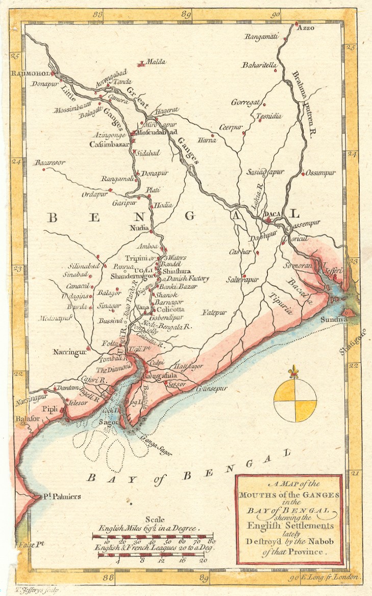
The Mouths of the Ganges in the Bay of Bengal
Published by Thomas Jefferys in the late 1750s, this map illustrates Bengal at the time of Carey's birth in 1761.
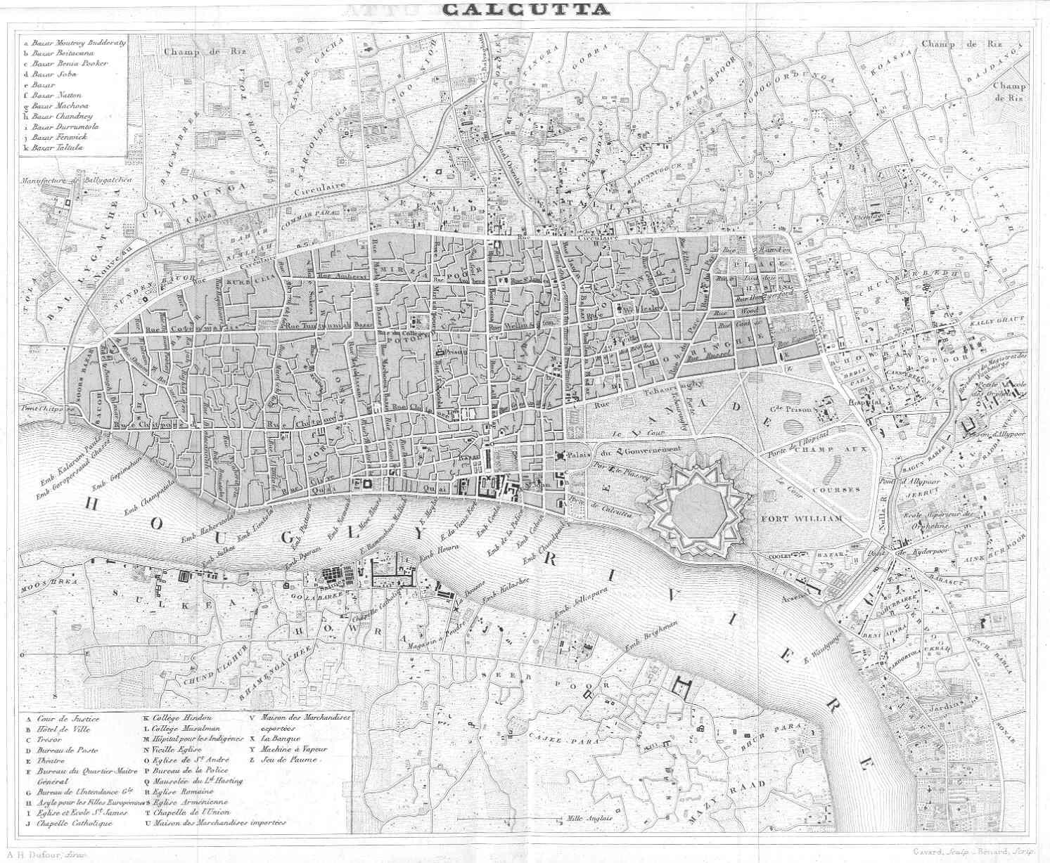
Drawn by A. H Dufour, engraved by Desbuissons, and published by Renouard, Paris.
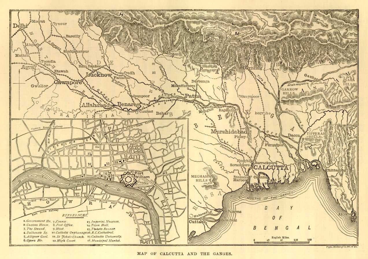
Calcutta and the Ganges River, 19th Century
Detail of the Hooghly River and Fort William College
in Bottom Left Inset
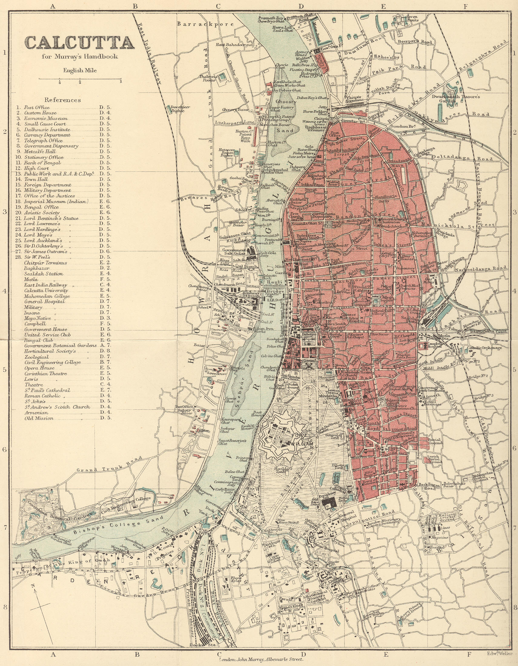
Calcutta Detail, 1901 (large file)
Detail of many icons during Carey's life shown at the height of the British Raj.
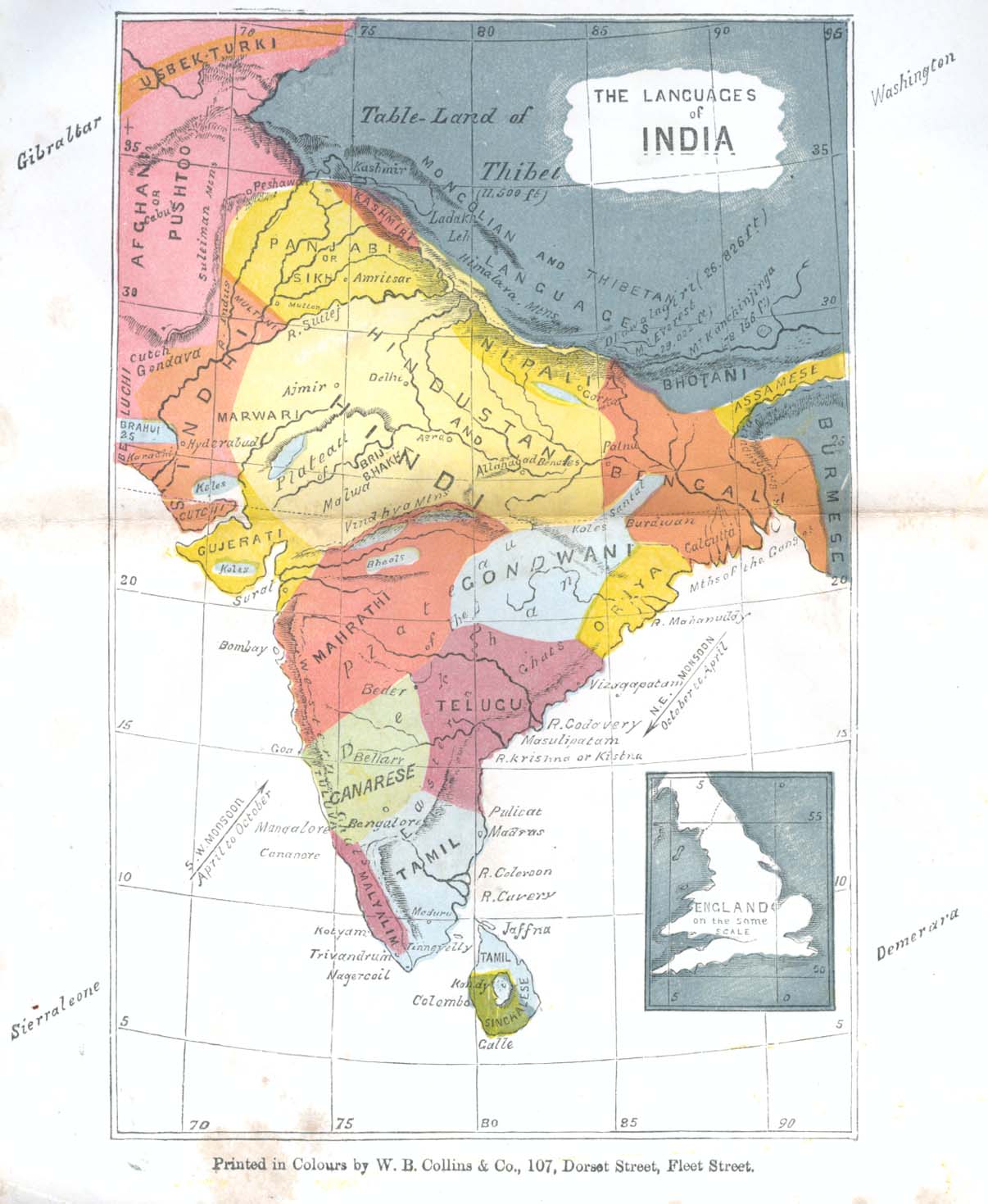
Published in the Baptist Magazine for 1859 to accompany "The Languages of India" [pp. 173-177].
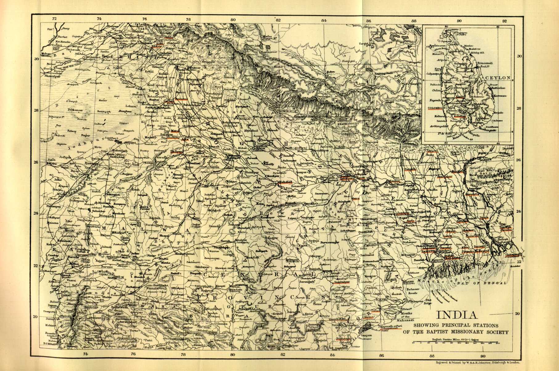
Missionary Stations of the Baptist Missionary Society, 1892
Missionary Stations of the Baptist Missionary Society, 1892,
in and Around Calcutta
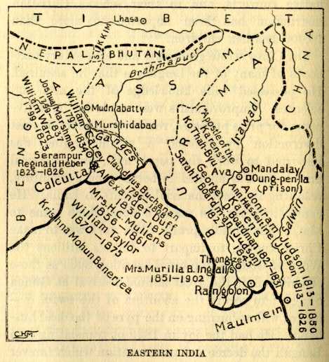
Christian Missionaries' Work in Bengal, India, ca. 1905
Christian Missionaries' Work in Northern India, ca. 1905
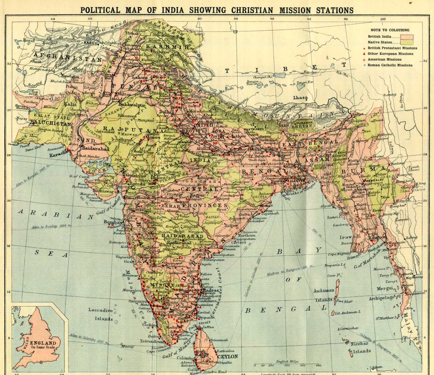
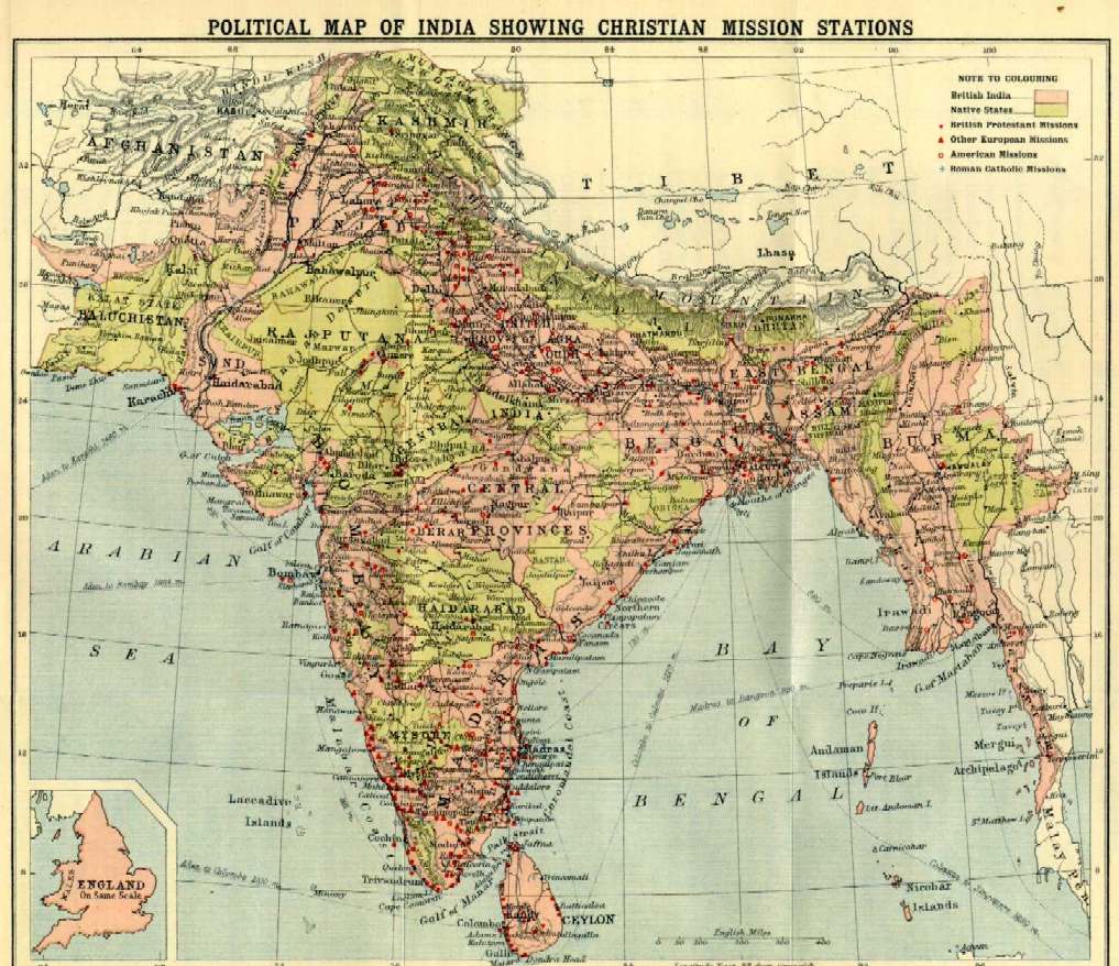
Political Map of India Showing Christian Mission Stations, ca. 1900
(for a smaller version of this map, click here).
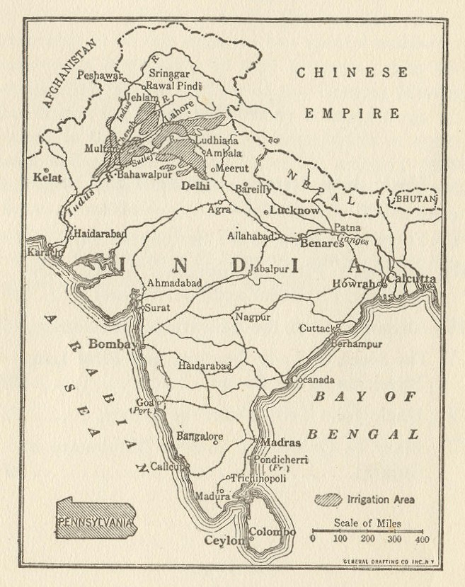
India in Relation to the Size of Pennsylvania, 1921
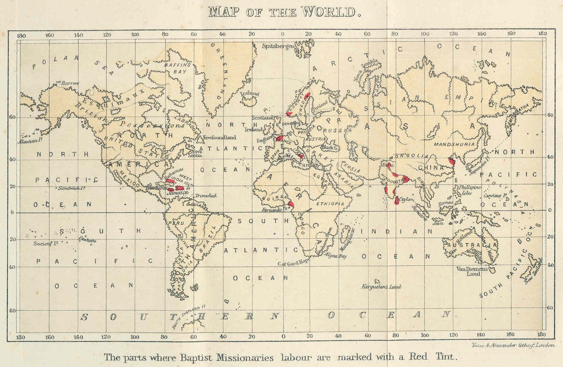
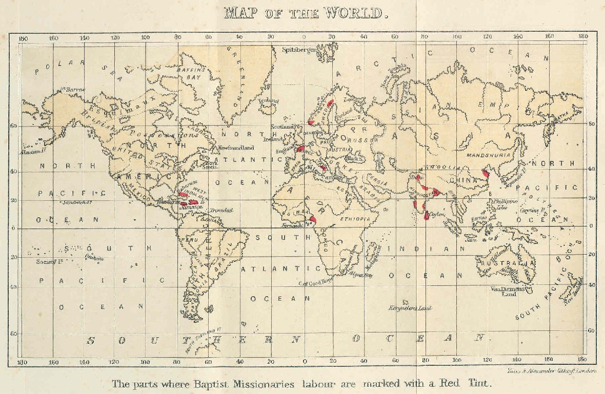
Baptist Missionary Society Map Showing Prevailing Religions of the World, 1873
(for a smaller version of this map, click here)
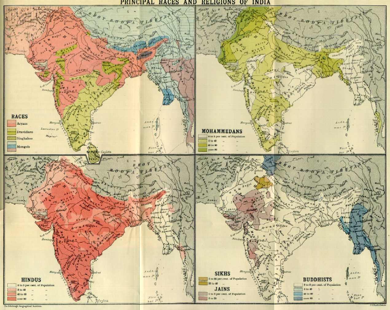
Races and Religions in India, ca. 1900
(for a smaller version of this map, click here).
Christian Missions in the World, 1825
Site of Salem Baptist Church, Mississippi Territory, 1798
Mississippi Territory and Spanish West Florida, 1798
Mississippi at Formation of First Baptist Convention, 1824
Mississippi at Formation of Mississippi Baptist Convention, 1836
Created: January 12, 2001 Updated: February 28, 2019